
Trace a DeSoto Street by Address
A DeSoto street-by-street search works best as a chain, rather than a single name list. The Dallas Central Appraisal District, or DCAD, is the current parcel starting point. Its card separates the parcel’s situs address, the physical location used for map and address searching, from the owner and the address used for correspondence. That distinction keeps a street search from turning a tax contact into an unsupported conclusion about a household. Once the parcel is stable, the legal description and account number carry the search into county deeds, plats, permits, and older address sources.
- Enter the full address in the DCAD address search. Save the account number, situs address, owner field, and legal description shown on the resulting card.
- Open the same parcel in the DCAD Property Map. Pan along the street and identify parcels one at a time when the task involves a segment rather than one address.
- Use the legal description, current owner, and any instrument reference in the Dallas County Official Public Records Search to locate deeds, releases, plats, or related documents.
- For a registration-status check, use the one-person Texas My Voter Portal with the required verification fields. It is not a public all-voters-on-a-street tool.
- For earlier occupants, ask Dallas Public Library or its digital partners about street sections and reverse directories. Treat each directory entry as a dated clue, then corroborate it with the parcel and deed trail.
That order keeps the parcel, not a loose name match, at the center of the address trail. It also works when a house number, direction, or postal label has changed over time.
Use DCAD for a DeSoto Address Search
DCAD’s address form is suited to research on a DeSoto street because it accepts a street number and street name, with optional direction, building, suite, city, and account type. The street type is left out of the street-name field. A From and To number range can narrow a street segment, which is more useful than repeatedly entering each address. If a number does not return a match, try direction changes, a street-name variant, nearby ranges, or the subdivision and legal description from a related record.
| DCAD field | Entry type | How it helps a street search |
|---|---|---|
| Number | Numeric text | Required for one address; From and To can browse a range. |
| Direction | Optional selection | Tests N, S, E, or W variants when the address uses one. |
| Street Name | Text | Required; use at least two characters and omit the street type. |
| Building and Suite | Optional text | Adds unit detail where the form supports it. |
| City and account type | Selection | Choose DeSoto where listed and narrow by Residential, Commercial, or BPP account type. |
The blue property-address result opens the appraisal card. That card can show account number, owner, mailing address, property address, legal description, values, exemptions, taxing entities, deadlines, and a sketch or map path. A homestead exemption may suggest an owner-occupancy claim, but it is not conclusive proof that a particular person lives there.
The DCAD address-search screen shows the number, street-name, city, and account-type controls used in the DeSoto address workflow.
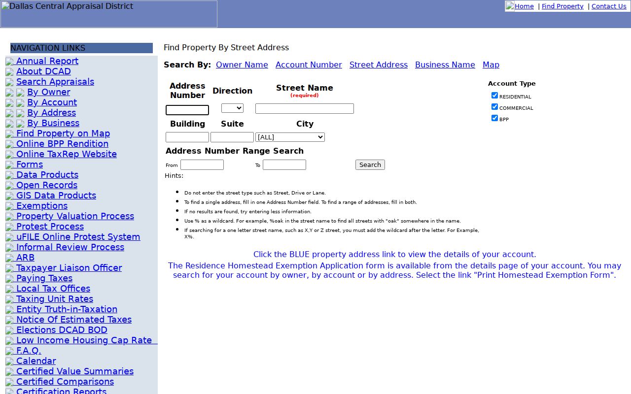
Its range fields are especially useful for checking adjoining numbers without treating the results as a household roster.
Map DeSoto Street Records by Parcel
The DCAD Property Map provides the street-by-street visual layer for a DeSoto address search. Its visible tools include parcel search, clear selection, length, area and latitude-longitude measurement, a legend, locate, printable map creation, feedback, basemap, and share controls. Search with an account number, a property address with or without a number or suffix, or an owner name written last name first name, without a comma or apostrophe. Select the parcel, open the identify or report route, then follow the property link to the appraisal card.
Pan and zoom can show adjacent polygons. They cannot identify every person connected with a street. Measurements are for orientation, not a legal survey. The city’s GIS resources add planning and neighborhood context, while DCAD supplies the parcel route. DeSoto warns that its map data are reference material and can change, so a city neighborhood polygon should never replace a plat or legal parcel boundary.
The DCAD parcel viewer is the source for its parcel-search and map controls.
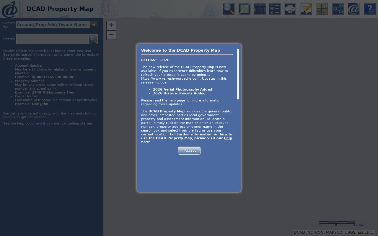
Use the identify path for each parcel separately, then compare its account card before drawing any conclusion about a street segment.
Separate DeSoto Situs and Mailing Addresses
Four fields can point in different directions during a DeSoto street directory search. The situs is the physical parcel location. The mailing address is where appraisal or tax correspondence goes. The legal description is the lot, block, subdivision, abstract, or metes-and-bounds language that ties title records to land. The DCAD account is the appraisal identifier, not the deed book and page or the street number. Use all four when two parcels have similar names or when a border-area mailing label conflicts with the mapped parcel.
- Parcel
- A mapped unit of land recorded in appraisal and title systems. It may have one street address but is best confirmed by its account and legal description.
- Situs address
- The physical property address used to locate a parcel in DCAD and on the map.
- Plat
- A recorded map that can connect a subdivision’s lot and block to streets, dedications, and boundaries.
- Criss-cross directory
- A reverse directory arranged by address or street, used to find the printed occupant entry for a particular date.
This field-by-field check is a useful local safeguard. DeSoto and De Soto spacing, directions, varied street types, postal-city labels, rural-route language, and subdivision names can all affect retrieval. When the street number fails, retain the cross streets, owner name, lot and block, or abstract rather than forcing a match.
Note: A mailing address can be a useful contact clue, but DCAD does not present it as proof of current residence at the situs.
Follow a DeSoto Street Deed Chain
For ownership changes along a DeSoto street, move from the current parcel card into Dallas County’s official records index. Search Property Records by grantor, grantee, subdivision, document type, document number, or a recorded-date range. Start with Index Only. The portal’s Index and Full Text or OCR option is better for a phrase likely to appear within an image. Record the instrument or document number, recording date, parties, legal description, book or page when displayed, and any image or certification option before proceeding.
A chain of title runs backward from the acquisition deed. Find the current owner as grantee, identify the seller, then search that seller as a prior grantee and the current grantee as a later grantor. The legal description and subdivision lot are the checks that prevent a search from slipping to the next address. When the current online index no longer carries the trail, the county-linked Kofile historical deed-index books provide Book, Volume, Page, party, and year controls for records from 1846 through 1963.
The Dallas County official-records search shows the grantor, grantee, document-type, date, and OCR controls used to start that record trail.
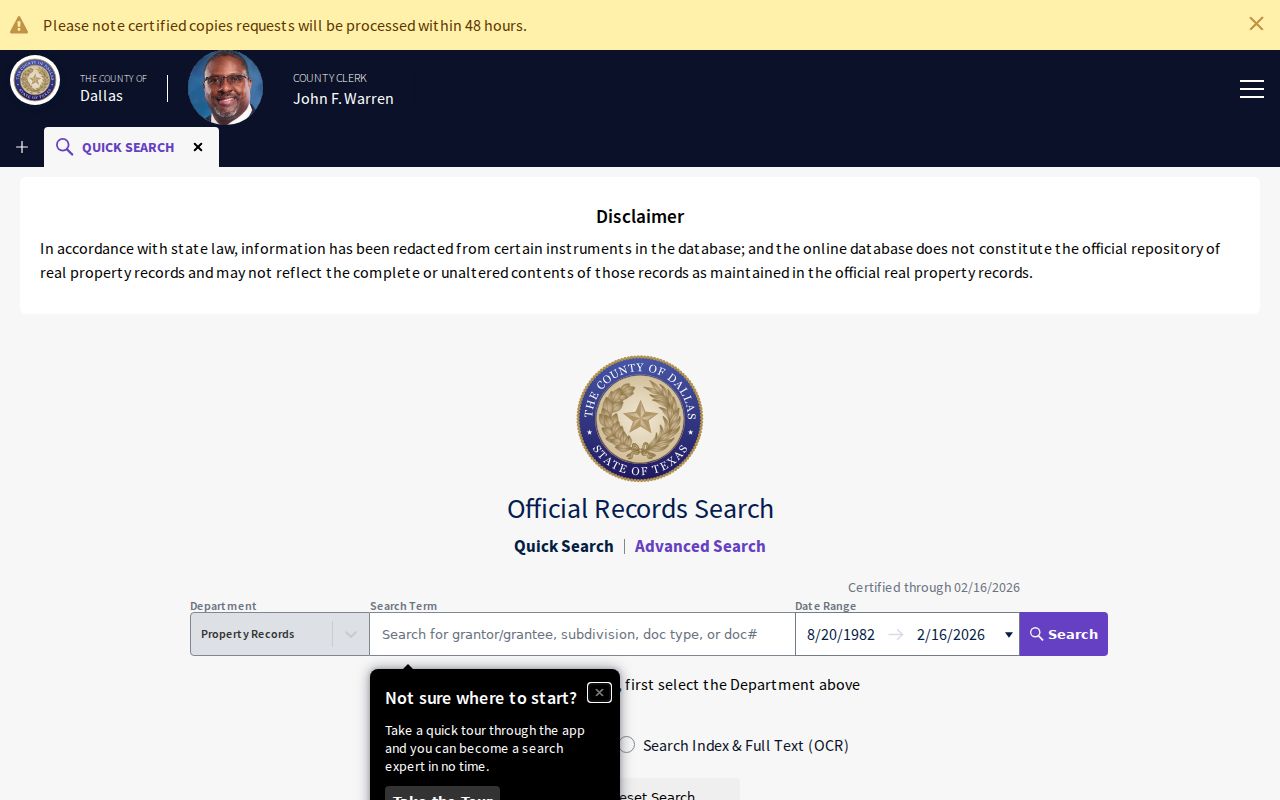
County index access is public, while plain copies and e-certified documents are paid options. Older record books and microfilm remain an in-person or request-route fallback through the County Clerk.
Check DeSoto Address Permits and Code Records
Address-keyed city records add timing and context to a DeSoto street directory, but they do not replace deeds. DeSoto Building Inspections uses the Customer Self-Service portal for permits and inspections. A permit can show a project, address, and inspection timing. It cannot by itself establish ownership or a current household. For older permit history, use the portal if it produces the needed public result, then make a narrow Texas Public Information Act request if the online field coverage is insufficient.
Code Enforcement can hold complaint, notice, mowing, action, lien, or case-contact material associated with an address. No public searchable DeSoto code-case database was located in the research. The practical fallback is the city’s Action Center or a tightly described request with the address, date span, and record type. Planning & Zoning can help with plats and legal descriptions; its page says 11 by 17 copies may be requested.
After September 5, 2025, DeSoto’s inspection guidance routes requests through Customer Self-Service. Confirm current instructions before relying on a requested inspection date.
Compare DeSoto Street Directory Sources
Each address record covers a narrow part of a DeSoto street. DCAD connects a parcel to current appraisal fields. The map supplies context. County deeds document recorded ownership interests. City systems add construction and enforcement history. Older directories and census material may supply dated occupant evidence, yet neither makes an address a current resident list. Keeping the sources separate is more reliable than treating one record set as an answer to every question.
| Address record | Custodian | Street-level evidence | Access path |
|---|---|---|---|
| DCAD parcel card | Dallas Central Appraisal District | Owner, mailing and situs address, legal description, values, exemptions, account | Free owner, address, or map search |
| Property map | DCAD | Parcel geometry, adjacent context, identify path | Public viewer, not a legal survey |
| Deed index | Dallas County Clerk | Grantor, grantee, instrument, date, document type, legal description | Official index; 1846-1963 books; copies paid |
| Plats | Planning & Zoning and County Clerk | Lot, block, streets, dedication, boundaries | Interactive and planning-request routes |
| Permits and code records | DeSoto city departments | Project, inspection, complaint, notice, or action by address | Customer Self-Service or narrow request |
| Historic directory or census | DPL, Portal, NARA | Dated address-to-occupant snapshot | Library, digitized collection, or released census |
Dallas County Clerk’s Recording Division also has a counter and copy route at the Records Building. A request should name the grantor or grantee, instrument number, document type, property address, city, date, and copy type. The form lists plain copies at $1 per page per document and certified copies at $1 per page plus $5 certification per document.
Note: County requests work best when the address is paired with an instrument number, party name, record type, and date range.
Use DeSoto Voter Records by Street
Texas voter information has a different structure from a parcel search. My Voter Portal uses a person’s name, county, date of birth, and ZIP, or a VUID plus date of birth, to check status. Dallas is the county choice for DeSoto. A result can help confirm registration status, precinct, polling information, and public voter identifiers. It does not show a ballot choice, and Texas does not register voters by a general party-affiliation field.
A statewide voter-file request is the route that can select mailing-address, effective-date, county, and status fields. The request form requires identifying and affidavit information and describes a deposit and later fee calculation. Election Code rules also restrict misuse and bar use of registration data to advertise or promote commercial products or services. Protected voters and Address Confidentiality Program participants have additional safeguards, so missing data can have many explanations.
The Texas My Voter Portal is the official one-person status interface for that limited check.
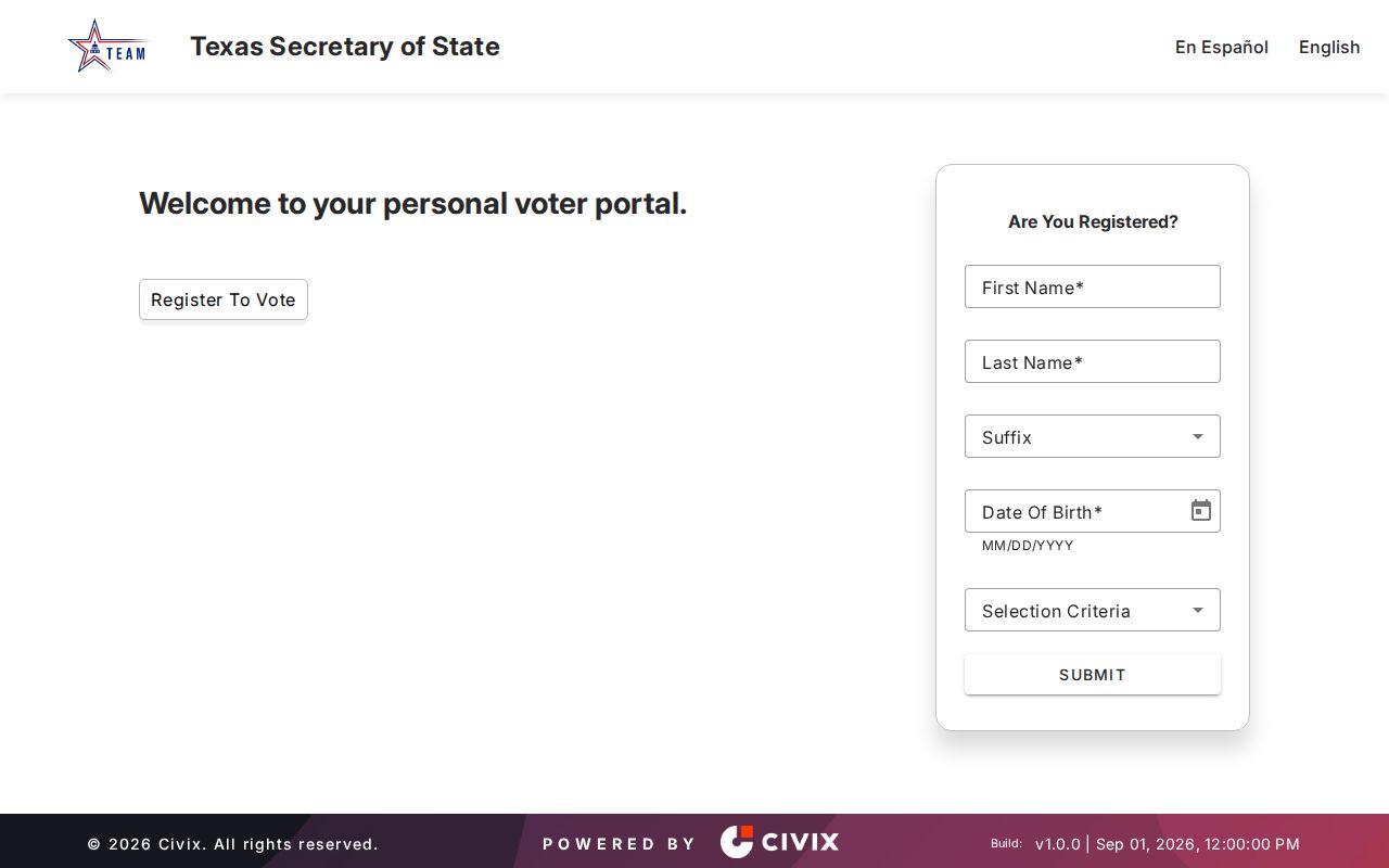
The form is useful for a careful status check after other records supply a name, but it is not a street-wide directory.
Keep DeSoto Street Names and Parcel Clues
DeSoto’s official street map is useful orientation for Belt Line, Hampton, Pleasant Run, Wintergreen, Parkerville, Cockrell Hill, Westmoreland, Danieldale, Clark, and subdivision streets. It is not a boundary survey. The research did not locate a numeric-quadrant explanation, formal E911 readdressing project, dated street-renumbering list, or complete annexation bridge. For an older address, retain the road name, direction, city and ZIP label, account number, subdivision, and legal description as separate pieces of evidence.
DeSoto lies near Duncanville, Lancaster, Cedar Hill, and Glenn Heights. A postal city label can differ from a municipal jurisdiction, especially near a border. Planning & Zoning and city GIS are the best local authority leads when a street label and a parcel jurisdiction do not agree. The city’s Planning & Zoning office can help locate plats with an address or legal description.
A number on a deed or map can have several meanings. DCAD’s 17-character account pattern identifies the appraisal account, while a lot and block or abstract identifies the land. Neither is interchangeable with a street number.
Read Older DeSoto Address Clues
Historical reverse and criss-cross directories are the address-first substitute when current parcel records are not enough. Dallas Public Library, the Portal to Texas History, and other regional collections have Dallas-area material, but the research did not verify a dedicated continuous DeSoto directory run. A historic street section can contain a number, name or initials, role abbreviation, an owner marker, a vacant notation, or an intersection. Preserve the printed form because DeSoto and De Soto spacing, initials, suffixes, and owner or vacant marks can be valuable search clues.
A vacant line does not prove that no one lived there. It may reflect publication timing, a transition, demolition, or new construction. Pair the entry with neighboring listings, deed and permit dates, and a released federal census when the time period allows. For a broader historical shelf, the DeSoto city directory page focuses on the regional collections rather than rebuilding them here.
Dallas County history also explains why an older street trail may be uneven. Courthouse fires damaged earlier county facilities, yet county clerk, court, and microfilm guides document surviving tax, court, deed, and related record groups. Check the relevant index or reel coverage before deciding an address has no historical record.
Note: A blank result in one older index does not rule out a surviving record in a different county series or microfilm reel.
What a DeSoto Street Directory Leaves Private
No DeSoto street directory establishes a complete household roster. Private household members, current unlisted occupants, utility subscribers, restricted motor-vehicle address information, protected voter addresses, and sealed court parties are not dependable public street sources. A deed records an ownership interest, not every occupant. A permit applicant may not be the owner. A map label and a mailing address need independent confirmation before either is used as a residence conclusion.
Lawful use. DeSoto address records support personal, lawful research and civic record questions. Do not use an address trail to stalk, harass, intimidate, or harm anyone.
Where an official record is missing online, use the proper custodian and ask for the narrowest relevant document and date range. That approach respects protected records and is more likely to produce a useful response.
Start with DeSoto Owner Search
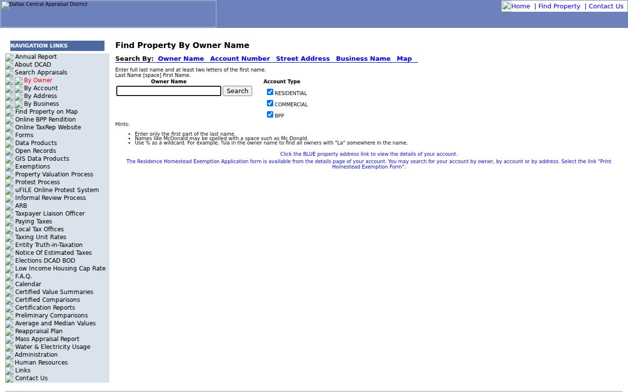
An owner-name search can recover a parcel when an address is incomplete. DCAD requires a last name and at least two first-name letters for its owner route. It accepts full or beginning surname text and documents a percent wildcard, while spacing variants such as McDonald and Mc Donald can matter. Residential, Commercial, and BPP choices narrow the account type. Use the blue address link on a result to return to the parcel card and test the situs and legal description against the street.
The DCAD owner-search screen is the source for the account-type controls and documented name-search tips.
Owner search is a recovery tool for a parcel trail, not a substitute for address, deed, and map verification.
Note: A matching owner name needs the address, account, or legal description to rule out another Dallas County parcel.