
Compare DeSoto Postal Labels
The DeSoto ZIP code directory has two postal labels documented in the official USPS material reviewed for this research. The DMM label list associates both 75115 and 75123 with DeSoto. That evidence confirms a city and state label association, not where each delivery route begins or ends. The inspected source does not classify 75123 as a delivery, post-office-box, or unique ZIP, and it does not supply a ZIP boundary map. Keep that uncertainty visible instead of assigning neighborhoods to a ZIP without an address-level USPS or GIS result.
| Postal label | Official label evidence | Post office reference | Record-search note |
|---|---|---|---|
| 75115 | USPS DMM label list identifies 75115 DESOTO TX 75115. | DeSoto Post Office, 229 S Hampton Road, DeSoto, TX 75115-9998 | The location result is postal evidence, not a municipal boundary. |
| 75123 | USPS DMM label list identifies 75123 DESOTO TX 75115. | A specific serving station was not located in the reviewed official source. | Delivery, post-office-box, and unique-ZIP classification remain unverified. |
Neither row is a resident list. The ZIP code directory is a postal starting point that must be reconciled with the parcel’s situs, legal description, city jurisdiction, and the date of the record being searched.
Verify DeSoto Postal Labels with USPS
The USPS DeSoto Post Office result identifies the location at 229 S Hampton Road and shows 75115-9998. The result listed retail and lobby hours of Monday through Friday 9 to 4, Saturday 9 to 12, and Sunday closed when inspected. Those details identify a post-office location. They do not explain the full ZIP code delivery geography of either DeSoto-labeled ZIP or decide whether a parcel falls inside city limits.
The related USPS DMM label list is the stronger source for the two postal-city labels. Use the exact address in an official USPS lookup before relying on a ZIP for mail delivery. Preserve the returned ZIP separately from the parcel’s city, county, DCAD account, and legal description. That recordkeeping matters near Duncanville, Lancaster, Cedar Hill, and Glenn Heights, where postal and governmental geographies can differ.
The official USPS location page is the source for this DeSoto postal result.
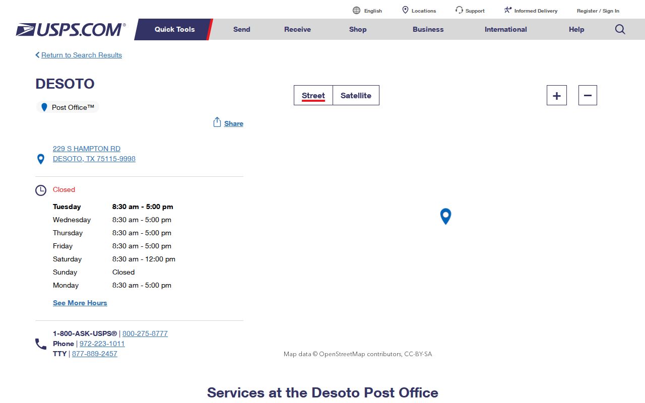
The screen provides a useful postal checkpoint, while city GIS and DCAD remain the sources for jurisdiction and parcel context.
Search DeSoto ZIP Records Carefully
A ZIP code can narrow a DeSoto records search, but the researched official tools do not publish a ZIP-wide resident directory. DCAD has address, owner, account, business, and map searches, rather than a documented public ZIP-wide household search. Its range search returns appraisal parcels, not every occupant. My Voter Portal is a one-person status tool, not a ZIP-wide search. The state’s full voter-file request provides regulated filter options, but that is a request process, not an ordinary public lookup screen.
- Verify the exact postal address with an official USPS result and record the ZIP without overwriting the city or county field.
- Run the physical address through DCAD address search and save the account number, situs, owner field, and legal description.
- Open the parcel in the DCAD Property Map to check map context and the property-report path.
- If a lawful voter-status check is appropriate, use the person’s name, Dallas County, date of birth, and ZIP in My Voter Portal. Do not treat it as a ZIP roster.
- Use the Dallas County records index with the owner, instrument number, or legal description when a deed or plat is needed for the same parcel.
After a ZIP narrows the area, the DeSoto street directory provides the fuller address-by-address parcel and deed sequence.
Note: A ZIP narrows an address search, but the full street address and parcel identifiers are the more durable record anchors.
Use DeSoto Parcel Fields and ZIPs
DCAD’s address form does not make ZIP code the primary published search field. The more reliable route is number, optional direction, street name, optional building or suite, city, and account type. A street name needs at least two characters, no spaces, and no street type. For one address, number and street name are the core fields. For a street segment, From and To numbers can be used. The city selection can help narrow a result, but the parcel card and map are still needed when a postal label and city jurisdiction may differ.
| DCAD search field | Input | ZIP search use |
|---|---|---|
| Number | Numeric text | Anchors the exact parcel or a From and To range. |
| Direction | Optional selection | Tests address variants when a direction is part of the postal address. |
| Street Name | Text | Enter the name without its street type; use the full address to avoid ZIP-only assumptions. |
| Building and Suite | Optional text | Keeps a unit or building designation attached to the physical address. |
| City and account type | Selection | Helps limit results by city and Residential, Commercial, or BPP account type. |
Search results lead through a blue property address to the appraisal card. That card can list an account, owner, mailing address, property or situs address, legal description, values, exemptions, taxing entities, and map path. None of those fields turns a ZIP label into a household roster.
The DCAD address form supplies the real controls used for that address search.
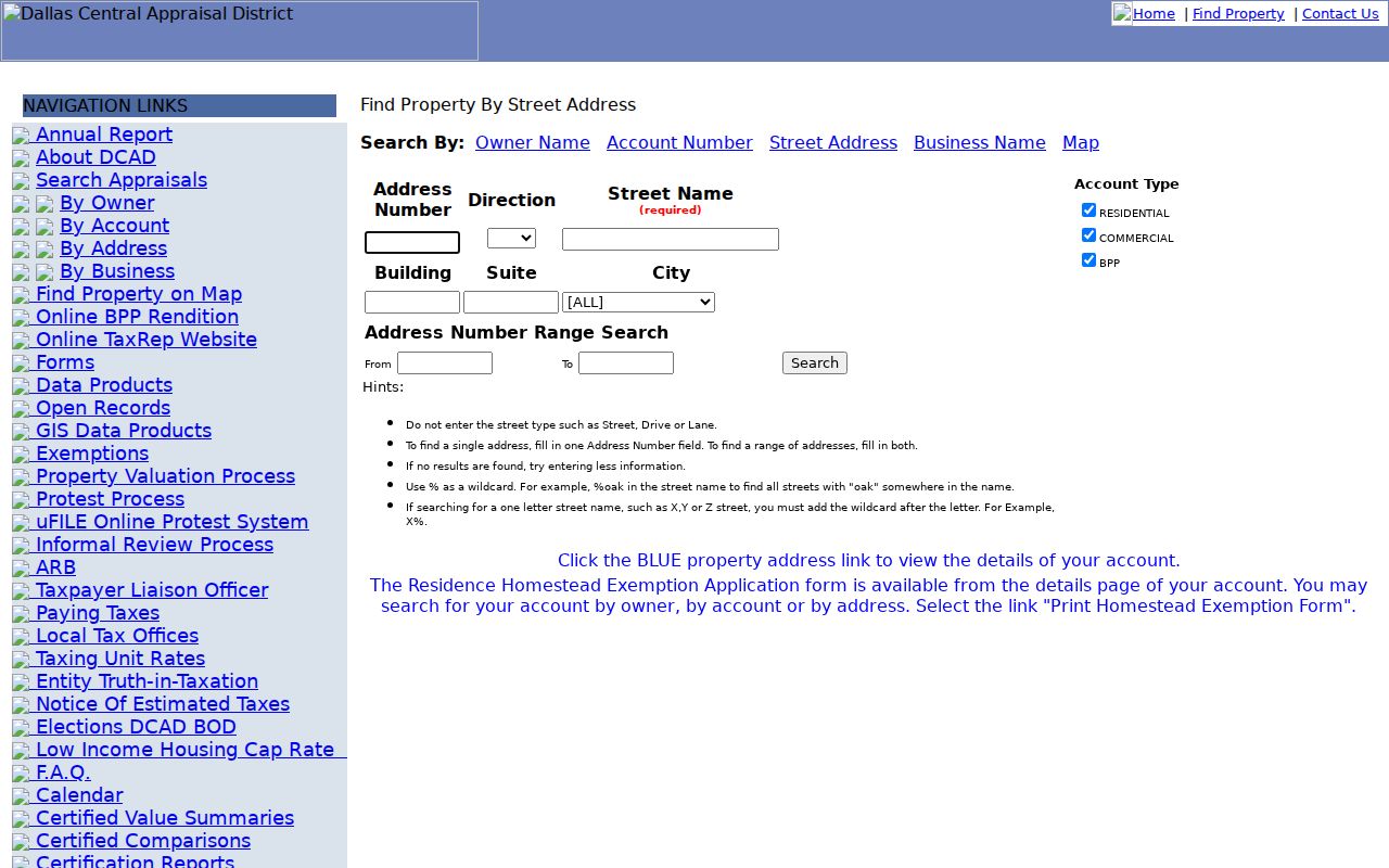
Enter the physical address first, then use its resulting parcel identifiers to verify the ZIP-related search trail.
Check DeSoto Voter ZIP Fields
Texas My Voter Portal uses ZIP code as one locator among several verification fields. Its name route uses first name, last name, county, date of birth, and ZIP. Dallas is the county to select for DeSoto. An alternative route uses a VUID with date of birth. A matching result generally supports a registration-status and precinct check; it does not disclose a ballot choice. A non-match can reflect a spelling issue, county choice, status, a recent move, list maintenance, incomplete input, or protected-address treatment.
The Texas full voter-file request is different. Its form offers choices for active, suspense, and cancelled records; effective-date ranges; age ranges; Texas mailing address filters; selected counties; and other fields. It requires requester details, an address that is not a post-office box, phone information, and a notarized affidavit. The form describes a $75 deposit and a fee calculation that should be confirmed with the current state quote before ordering.
Election Code protections still apply. Social Security, Texas driver-license, and DPS identification numbers are confidential. Protected voter and Address Confidentiality Program rules can suppress or substitute addresses. Do not republish address data or use a regulated file as a public DeSoto postal directory.
Note: A voter lookup result supports a limited status check and should not be treated as proof of a current household.
Compare DeSoto ZIPs with Parcel Fields
Postal geography is only one layer of an address. USPS ZIP is a delivery geography. City limits are governmental geography. DCAD situs is the mapped parcel location. DCAD mailing address is the correspondence destination. A deed’s legal description is title and recording geography. They can all differ on the same record trail. For a search involving a border, retain each value rather than copying the postal city into every field.
DCAD owner search can recover a parcel when a street address is incomplete. It requires a last name and at least two first-name letters for the owner route, accepts partial names, and has Residential, Commercial, and BPP account types. Surname-spacing variants can matter. Once the result opens, compare its situs and legal description to the address instead of relying on a mailing address as a residency conclusion.
The DCAD owner-search screen shows the name and account-type controls used to reconnect a DeSoto ZIP search to a specific parcel.
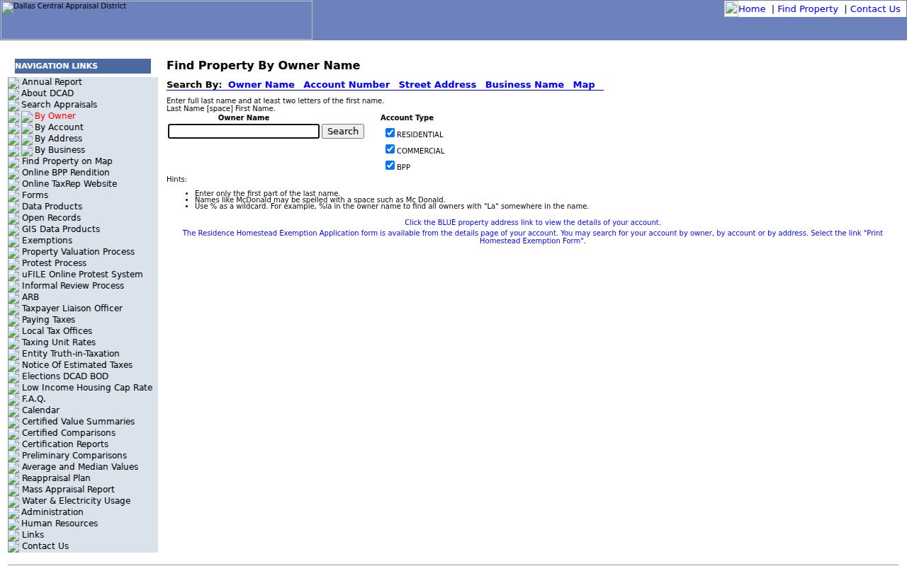
Owner search can help resolve an incomplete record, but the parcel card and legal description remain the stronger address checks.
Reconcile DeSoto Postal Labels and City Limits
A DeSoto mailing label may appear outside current municipal limits, and a parcel near the border may carry a neighboring postal label. The official city street map, city GIS and zoning resources, DCAD jurisdiction, and USPS result should be reconciled address by address. The research did not locate an official ZIP boundary map, a per-ZIP population table, voter-registration counts by ZIP, a ZIP split date, or a neighborhood-by-ZIP table. Those gaps are reasons to verify, not reasons to estimate.
- ZIP and ZIP+4
- A ZIP identifies a postal delivery area. ZIP+4 adds a more specific delivery segment; neither is a city-limit ruling.
- Post-office-box ZIP
- A ZIP used for post-office-box service. The reviewed source did not establish whether 75123 has this classification.
- Unique ZIP
- A ZIP assigned to one organization or high-volume recipient. The reviewed source did not identify a unique DeSoto ZIP.
- Carrier route
- A postal delivery sequence used to route mail. It is not a publicly verified parcel-boundary layer in the researched sources.
Note: For a ZIP-coded record, preserve the full address, ZIP, city, county, DCAD account, and legal description as separate fields.
Place DeSoto ZIPs in Historic Context
Historic address research needs more than a modern ZIP label. DeSoto incorporated in 1949, but a pre-incorporation address may appear in rural Dallas County context rather than under present city boundaries. The research did not locate a dated annexation or address-change table. For earlier records, search the road name, subdivision, lot and block, tract or abstract, nearby cross street, and county context. Dallas-area directories, census geography, plats, and deeds are more dependable historical anchors than applying a current ZIP to an old record.
Dallas County was organized in 1846. Its record history includes courthouse fires, yet tax, court, deed, and other microfilmed records survive in particular series. The practical lesson is to check the relevant index or reel before deciding a person or parcel disappeared from the record. The city’s older Belt Line and Hampton crossroads and the 1881 post-office history may also supply useful road-name context, but no continuous DeSoto directory run was verified.
Keep DeSoto Postal Address Systems Separate
Permits, code complaints, planning and zoning, utility districts, and school attendance zones are separate address systems. DeSoto’s Customer Self-Service portal is the city route for permit and inspection material. City Planning & Zoning and GIS are useful for plats and city context. No official public utility-customer directory or complete school-zone finder was located in the research. A permit applicant is not necessarily an owner, and a permit date is not an occupancy record.
The DCAD Property Map can identify parcels and map context, while city GIS adds planning information. Neither is a public people directory. The map’s measure tools help with orientation, not legal boundary proof. For a city-limit question, use the city’s official map or Planning & Zoning route along with the parcel’s jurisdiction rather than a ZIP alone.
Recognize DeSoto ZIP Directory Limits
A DeSoto postal directory cannot identify everyone who receives mail, occupies a household, uses a utility account, or has a motor-vehicle record. Current renters, private household members, utility subscribers, protected voter addresses, and restricted motor-vehicle data are not reliable public ZIP-level sources. Historical reverse directories can offer an address-to-name snapshot, but Dallas-area material does not establish a continuous dedicated DeSoto run.
Address check. Use a ZIP as a postal locator, then confirm the physical parcel through DCAD, the map, city jurisdiction, and the appropriate county record.
For a missing official record, contact the custodian with the address, date span, account or instrument identifier, and precise record type. Narrow requests are more useful than asking for every record associated with a ZIP.
Note: The research did not locate an official public ZIP-wide directory of DeSoto residents, utility subscribers, or all address occupants.